Buscar tours
La Fortuna

Acerca de La Fortuna

La Fortuna occupies the northern lowlands of Costa Rica directly beneath the 5,358-foot Arenal Volcano. This agricultural district transformed into an ecotourism hub following a massive 1968 eruption that reshaped the local geography.

Arenal Volcano Elevation 5,358 feet
Distance from San José 75 miles (120 km)
Waterfall Height 230 feet (70 meters)
Waterfall Descent 530 concrete steps
Year Founded Early 1930s (as El Burío)
1968 Eruption Casualties 82 deaths
Public Parking Cost 700 CRC per hour
Distance to Volcano 4 miles (6.4 km)

Descripción general

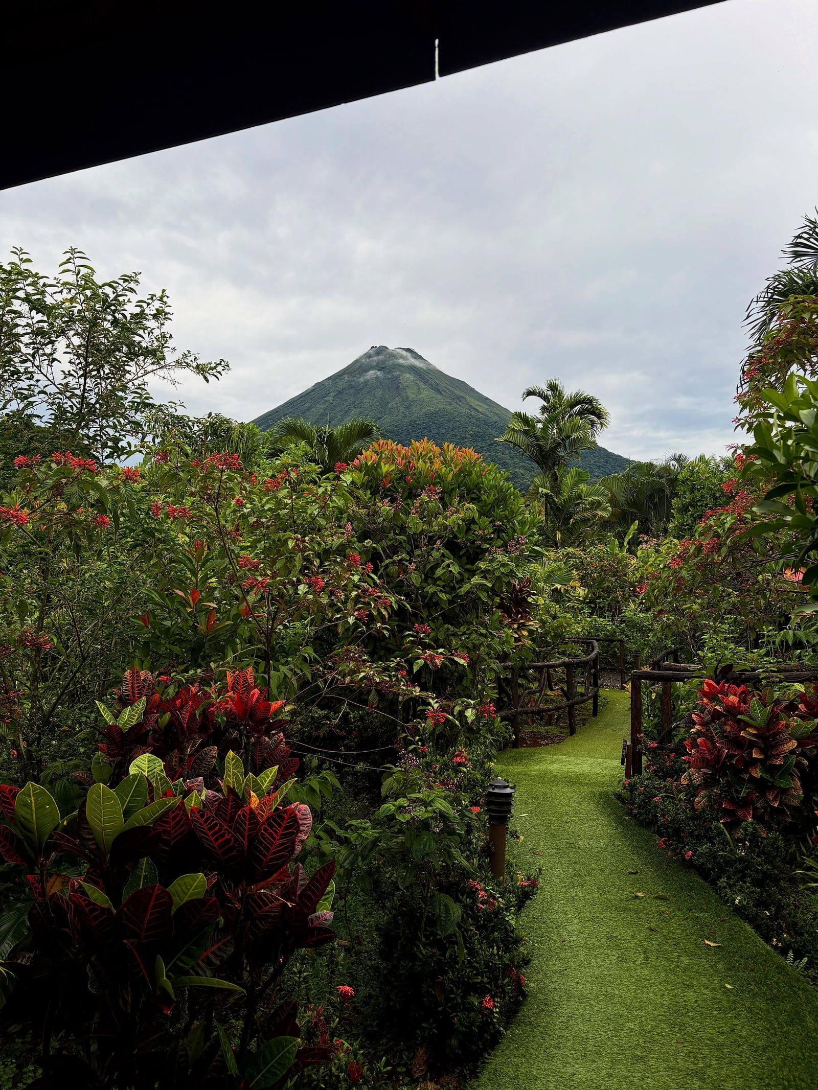
La Fortuna occupies the flat San Carlos plains in Costa Rica's northern lowlands, sitting exactly 75 miles northwest of the capital city, San José. The 5,358-foot cone of Arenal Volcano dictates the geography of the entire district, rising abruptly from the surrounding pastureland. This active stratovolcano heats a massive underground aquifer. The magma-warmed water breaches the surface throughout the valley, creating dozens of mineral-rich hot springs that flow at temperatures between 90 and 105 degrees Fahrenheit. Visitors access these geothermal rivers through luxury resorts like Tabacón or via the free public river access located directly across the street.

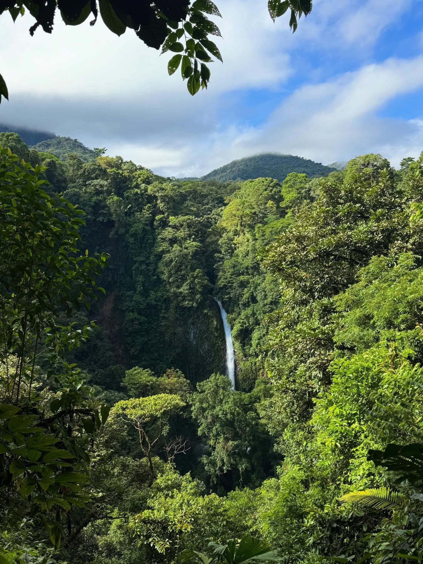
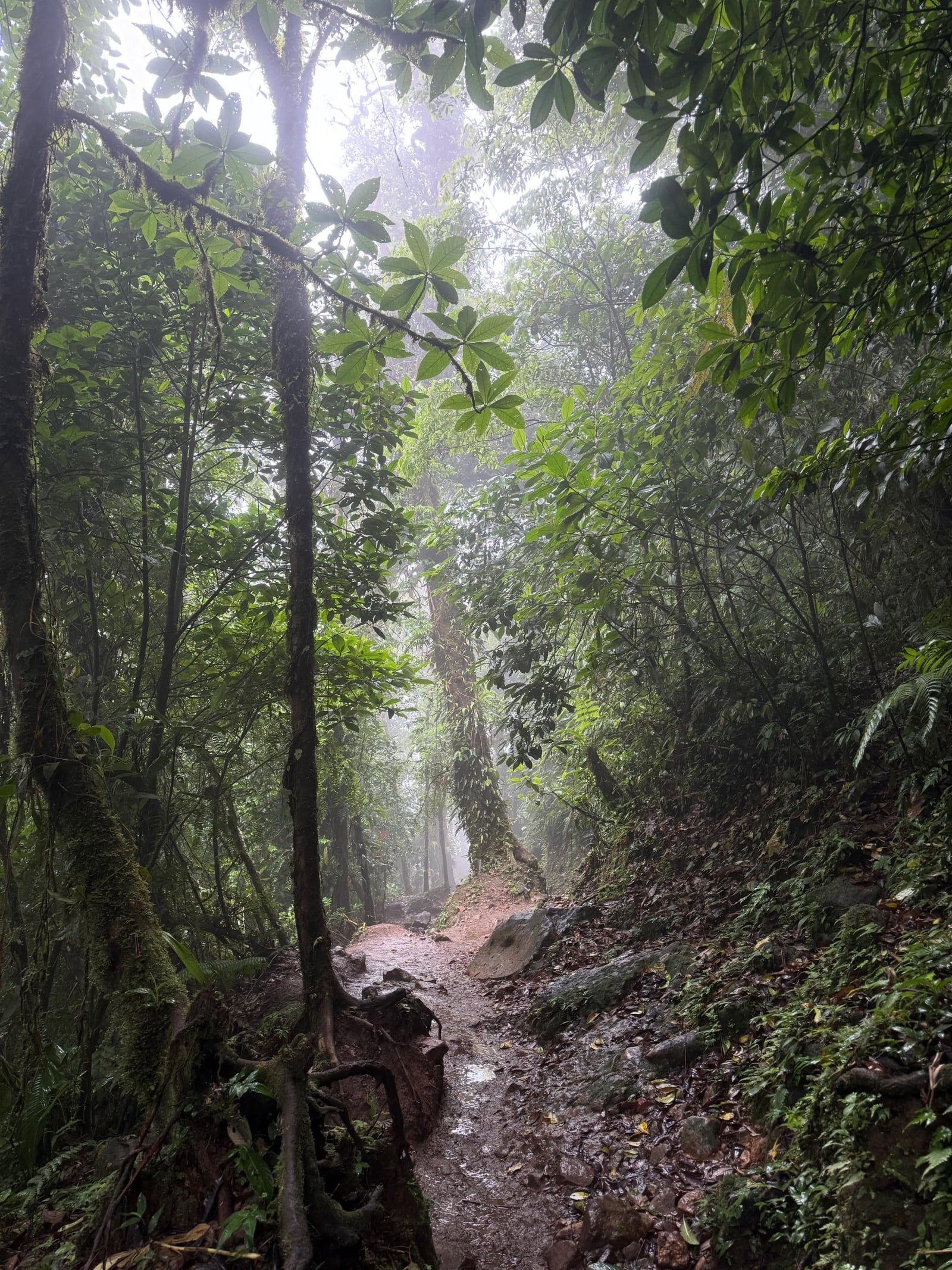
Dense primary and secondary rainforests blanket the volcanic slopes and surrounding canyons. This ecosystem supports high concentrations of tropical wildlife. Two-toed sloths hang from the cecropia trees along the downtown Bogarin Trail, while howler monkeys traverse the canopy above the Mistico Hanging Bridges. The region receives heavy annual rainfall, which feeds the Fortuna River. This waterway culminates in the La Fortuna Waterfall, a 230-foot cascade that plunges off a sheer basalt cliff. Visitors must descend 530 concrete steps to reach the base. The spray hits your face 20 meters before you reach the plunge pool. Swimming directly under the 70-meter drop is illegal due to violent undertows, forcing swimmers to use the designated calm water zones downstream.

The district operates as a highly organized ecotourism hub, but the weather dictates daily schedules. The dry season runs from December through April, offering clear skies and stable river currents. From May to November, the green season brings intense afternoon downpours. These storms swell the rivers rapidly, turning the water brown and creating dangerous flash floods. Tour operators routinely cancel white-water rafting trips and close waterfall access during heavy rain. You must check the official park websites each morning before departing your hotel. Paved roads connect the central downtown grid to all major trailheads, eliminating the need for a 4x4 vehicle unless you book a remote eco-lodge on the outskirts of town.

Vista de La Fortuna

Historia y orígenes

Early Settlement and Agricultural Roots

The modern history of La Fortuna began in the early 1930s. Farmers migrating from the central valley towns of Grecia, Naranjo, and Ciudad Quesada arrived in the northern lowlands seeking unclaimed land. They cleared sections of the dense jungle using machetes and axes to establish a small agricultural settlement originally named El Burío. The local soil contained centuries of unrecorded volcanic ash deposits, making it exceptionally fertile. Farmers produced massive yields of papaya, yucca, beans, and corn. In 1948, local leaders Rufino Quesada, Antonio Hidalgo, and Isolina Quesada petitioned the government to rename the village. They chose La Fortuna, meaning 'The Fortune,' to reflect the financial stability the volcanic soil provided. The Costa Rican government officially recognized the district on February 5, 1952, through Decreto Ejecutivo 15.

The 1968 Arenal Eruption

Arenal Volcano remained a silent, heavily forested mountain for centuries, with locals unaware of its active status. That changed on the morning of July 29, 1968. The mountain exploded without warning, blasting ash, pumice, and toxic gas from a new crater on its western flank. The violent eruptions continued uninterrupted for three days. Fast-moving pyroclastic flows swept down the slopes at hundreds of miles per hour. The superheated debris completely buried the nearby farming communities of Tabacón, Pueblo Nuevo, and San Luis. The disaster killed 82 residents and destroyed thousands of acres of livestock pasture. The eruption altered the local topography permanently, leaving behind massive fields of jagged black basalt rock that still dominate the western slopes today.

Transition to Global Ecotourism

The 1968 tragedy inadvertently transformed La Fortuna into a global destination. Following the initial explosion, Arenal entered a phase of continuous, slow-moving lava eruptions. Geologists, researchers, and thrill-seekers flocked to the region to watch glowing boulders tumble down the mountain at night. Locals responded by building small cabins, restaurants, and viewing platforms to accommodate the influx of foreigners. Developers discovered the geothermal rivers heated by the magma and began constructing hot spring resorts in the 1990s. The visible lava activity slowed and eventually ceased entirely in 2010. Instead of facing an economic collapse, the town pivoted to adventure tourism. Operators built zip-line cables across the canyons and suspended bridges through the canopy. Today, the local economy relies heavily on visitors coming to hike the 1968 lava fields, navigate the rainforest, and soak in the thermal rivers.

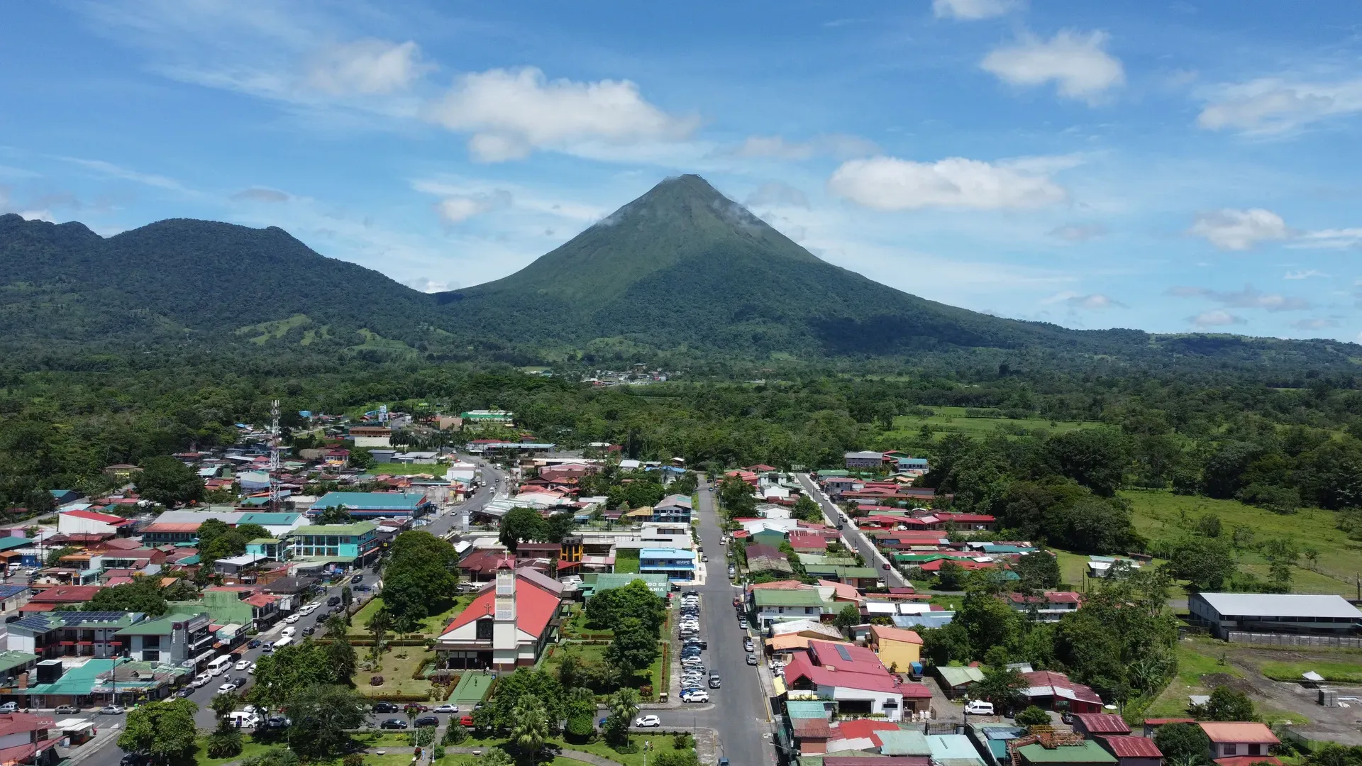
Vista de La Fortuna
1930s Farmers from Grecia and Naranjo establish the agricultural settlement of El Burío.
1948 Residents rename the village La Fortuna to reflect the high crop yields from the volcanic soil.
1952 The Costa Rican government officially establishes the district via Decreto Ejecutivo 15.
1968 Arenal Volcano erupts on July 29, killing 82 people and burying three neighboring villages.
2010 Visible lava flows cease, prompting the town to fully transition from volcano watching to adventure ecotourism.

Geology & Natural Features

Arenal Volcano dictates the physical and geological landscape of the entire district. The 5,358-foot stratovolcano features a nearly perfect symmetrical cone, built over thousands of years from alternating layers of ash, rock, and lava. The western flank remains scarred by the 1968 eruption, completely devoid of vegetation and covered in sharp, jagged basalt boulders. To the immediate southeast sits Cerro Chato, a 3,740-foot dormant volcano. Unlike Arenal, Cerro Chato is heavily forested and features a collapsed caldera filled with an emerald-green crater lake. The geological fault lines beneath these twin peaks allow groundwater to seep close to the subterranean magma chambers. The superheated water absorbs sulfur, calcium, and magnesium before rising back to the surface to form the Tabacón River and dozens of smaller geothermal springs.

Twenty kilometers west of town lies Lake Arenal, Costa Rica's largest landlocked body of water. The lake covers 85 square kilometers and sits at the base of the volcano's active western face. An earth-fill dam at the eastern end regulates the water flow, generating nearly 12 percent of the country's total hydroelectric power. High winds whip across the flat water surface year-round, creating ideal conditions for windsurfing and kiteboarding. The northern shores transition abruptly into primary rainforest. This dense canopy blocks out most sunlight, forcing understory plants to grow massive leaves to capture any available rays. Epiphytes, including bromeliads and orchids, cling to the trunks of towering ceiba trees to access the light.

The La Fortuna Waterfall cuts through this jungle terrain 5.5 kilometers south of the town center. The Fortuna River drops 230 feet off a sheer basalt cliff directly into a massive plunge pool. The sheer force of the falling water carves deep grooves into the surrounding rock face and generates a constant, deafening roar. Mist coats the canyon walls entirely, supporting thick layers of moss and ferns that cling to the wet stone. The 530-step descent requires physical stamina, and the 30-minute climb back up in 90-degree humidity tests most hikers. The water temperature in the pool hovers around 70 degrees Fahrenheit, providing a sharp contrast to the geothermal hot springs located just a few miles away.

Vista de La Fortuna

Importancia cultural

The indigenous Maleku people consider the rivers, forests, and volcanic peaks around La Fortuna to be deeply sacred. Before Spanish colonization, their ancestors relied on the local waterways for fishing, transportation, and spiritual cleansing ceremonies. The La Fortuna Waterfall remains a site of deep reverence, representing the physical manifestation of earth and water spirits. Today, fewer than 1,000 Maleku remain in the northern region, living primarily in the Guatuso Indigenous Reserve just north of the district. They maintain their traditional language, known as Maleku Jaíka. Artisans carve intricate wooden masks from balsa wood, depicting the jaguars, macaws, and toucans that inhabit the Arenal forests. These carvings record their ancestral connection to the local wildlife.

Agricultural traditions still dictate the daily rhythm of the native Costa Ricans, or Ticos, who live outside the immediate tourist grid. Coffee and cacao plantations line the rural dirt roads leading out of town toward the Nicaraguan border. Farmers harvest cacao pods entirely by hand, splitting the tough outer shells with machetes. They ferment the raw beans in wooden boxes for several days before spreading them on massive wooden racks to dry in the sun. This hands-on process connects modern residents directly to the pre-Columbian era, when indigenous populations used fermented cacao beans as actual currency. Visitors can participate in this process at local farms, roasting the dried beans over open fires and grinding them into a bitter paste.

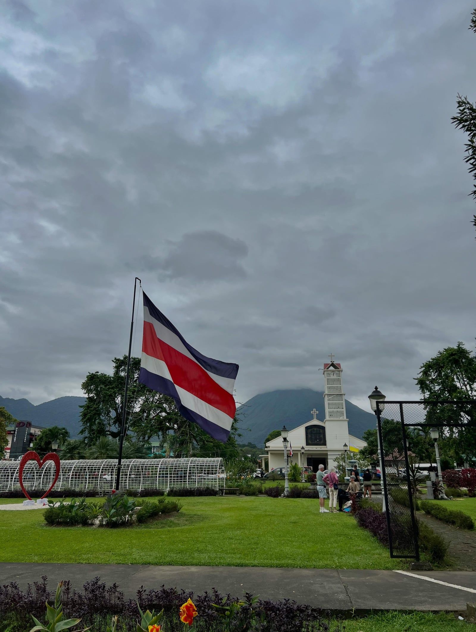
Community rules strictly protect vulnerable populations and maintain order in the busy downtown sector. Photography is completely banned at the Hogarcito San Juan Bosco transition home to ensure the safety and privacy of the children living there. Local laws also mandate payment for numbered street parking in the central town square, with all funds supporting municipal infrastructure and road repairs. A parking ticket costs roughly $15 USD. If you ignore the ticket, rental car agencies will charge the fee directly to your credit card along with an administrative penalty. Flashy jewelry and large amounts of cash draw unwanted attention, so locals advise leaving valuables locked in hotel safes when walking the streets at night.

Vista de La Fortuna

Datos interesantes

🌋

Name Origin

Settlers originally called the town El Burío before renaming it La Fortuna in 1948 to celebrate the highly fertile volcanic soil.

☠️

Buried Villages

The 1968 Arenal eruption completely buried the nearby towns of Tabacón, Pueblo Nuevo, and San Luis under fast-moving pyroclastic flows.

🦥

Downtown Sloths

The flat Bogarin Trail sits right in downtown La Fortuna and guarantees sloth sightings, with guides using telescopes to spot them in the cecropia trees.

💧

Free Hot Springs

You can soak in naturally heated geothermal water for free in the public river located directly across from the Tabacón Thermal Resort.

🚷

Crater Ban

Hiking to the crater of Arenal Volcano is strictly illegal due to the constant emission of toxic gases and highly unstable slopes.

🚗

No 4x4 Required

The main roads connecting the town center to the national park and waterfall are fully paved, allowing standard sedans to navigate easily.

🍫

Cacao Currency

Local chocolate tours demonstrate how indigenous populations in the region once used fermented cacao beans as actual currency for trade.

Preguntas frecuentes

What is La Fortuna known for?

La Fortuna is the primary basecamp for exploring the Arenal Volcano and its surrounding geothermal hot springs. The district features a 230-foot waterfall, primary rainforests, and a massive network of canopy suspension bridges. It transitioned from a quiet farming village to Central America's ecotourism capital after the 1968 volcanic eruption.

How did La Fortuna get its name?

Settlers originally named the town El Burío in the 1930s. Residents changed the name to La Fortuna in 1948 to honor the highly fertile volcanic soil. The new name translates to 'The Fortune,' reflecting the massive crop yields farmers achieved.

What happened during the 1968 Arenal eruption?

On July 29, 1968, Arenal Volcano erupted violently after centuries of dormancy. The blast sent ash, toxic gas, and rocks flying for three days, killing 82 people. The pyroclastic flows completely buried three nearby villages and permanently altered the region's topography.

How tall is the La Fortuna Waterfall?

The waterfall drops 230 feet (70 meters) over a sheer basalt cliff into a blue plunge pool. Visitors must descend 530 concrete steps through a dense rainforest canyon to reach the base. The hike down takes 15 minutes, while the steep climb back up requires about 30 minutes.

Is it safe to swim at the La Fortuna Waterfall?

Swimming directly beneath the 70-meter drop is illegal and highly dangerous due to violent undertows. Visitors can swim safely in the designated, calmer river sections located just to the left of the main pool. Lifeguards monitor the area, but rocks in the water are extremely slippery.

Can you hike to the top of Arenal Volcano?

Climbing to the crater of Arenal Volcano is illegal and life-threatening. The summit emits toxic gases, and the steep slopes are highly unstable. Hikers must stay on the designated trails at the base, which navigate through the 1968 lava fields.

Are there free hot springs in La Fortuna?

A natural hot spring flows through the public river directly across from the Tabacón Thermal Resort entrance. Access to the water is free, though local parking attendants on the road charge a small fee to watch vehicles. The rocky riverbed lacks lighting, so visiting after dark requires a headlamp.

What is the best time of year to visit La Fortuna?

The dry season from December through April offers the clearest views of the volcano and safest river conditions. Heavy rains from May to November frequently muddy the trails and cause flash floods. Tour operators regularly cancel rafting and waterfall trips during afternoon downpours in the green season.

How far is La Fortuna from San José?

The town sits 75 miles (120 kilometers) northwest of San José. Driving a rental car takes roughly 2.5 to 3 hours along paved, winding mountain roads. Public buses depart daily from the capital and take up to six hours to complete the same route.

Do you need a 4x4 vehicle in La Fortuna?

A standard sedan can easily navigate the fully paved roads connecting the downtown grid to the waterfall, hot springs, and national park. You only need a 4x4 if you book a remote eco-lodge located on unpaved, steep dirt roads outside the main tourist zone. Renting a car provides flexibility, as attractions are spread miles apart.

¿Listo para visitar La Fortuna?

Explora tours verificados con cancelación gratuita y confirmación instantánea.

Buscar tours